South Atlantic
Atlantic Ocean, South of the equator
Jump To:
Future Storms
Basin Details
Current Storms
Storm Names
Averages/History
Area: Atlantic Ocean, South of the Equator
Basin Details
Season: Year round (Peak: Likely first few months of the year)
Governing Body: None. May be covered by (Forecast/data/names may vary widely between them):
Season notes: Rare, but does occur, most considered Sub-Tropical
Current Storms
Note: See below first map for specific storm data.
This image updates every six hours from 1June-30November at 5 & 11am/pmHST, 5 & 11am/pmEDT(4 & 10a/pEST); 2 & 8am/pmPDT(1 & 7a/pPST). It will also update any time as needed (ie: for a January system, etc.). Date & Time last updated located in bottom left.
Future Storms
This image updates every six hours from 1June-30November at 2 & 8am/pmHST, 2 & 8am/pmEDT(2 & 7a/pEST); 5 & 11am/pmPDT(4 & 10a/pPST). It will also update any time as needed (ie: for a January system, etc.). Date & Time last updated located in bottom left.
Next two days:
Next seven days:
(NHC moved from 5-day to 7 in 2023)
Storm Names
There are no official name list by the World Meteorological Organization (WMO) (which helps decide cyclone name list for many other regions of the globe) for the South Atlantic basin. Below are name list generated by select countries of South America. The same storm may receive multiple names depending how each country handles a systems development, track and intensity.
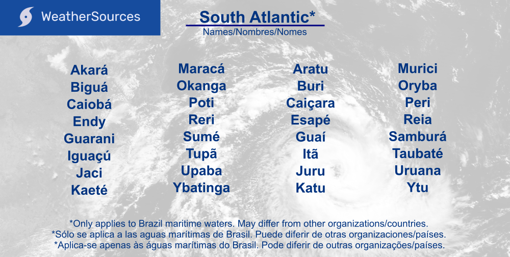
The names above are from here.
Averages / History
Studying the past can help you plan the future. From beach trips, shipping cargo, insurance cost, to keeping your home safe, etc. Averages are averages, so storms can fall outside of the data, dates & boundaries shown below.
Zoomed in view of historical tropical cyclone tracks for the South Atlantic basin.
Historical tropical cyclone tracks for the South Atlantic basin.
Image credit: NHC/NOAA (Source); data 2004 to 2021. This may differ from other organizations historical maps.
Note: Weather satellites did not exist until 1960's & sub-tropical storm classification rules have changed, some data may be missing.
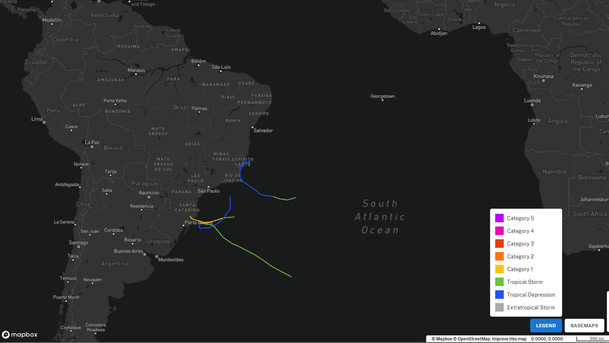
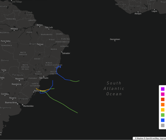
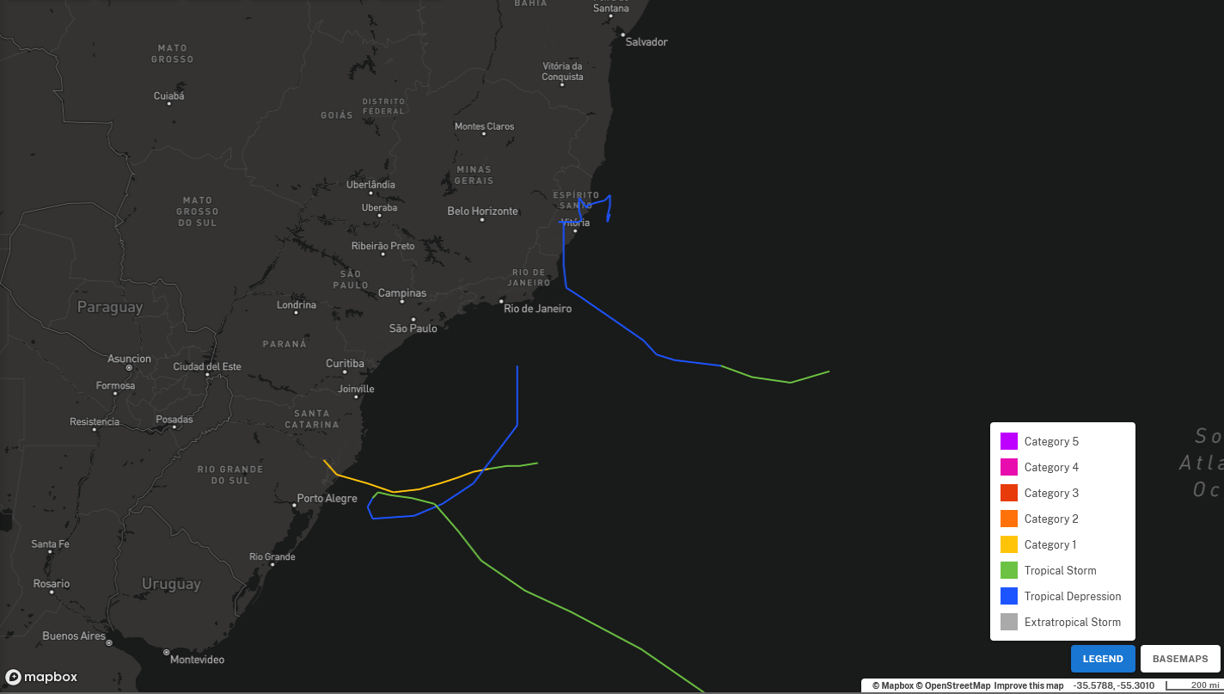
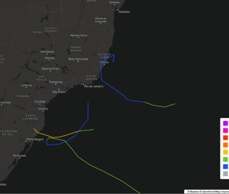
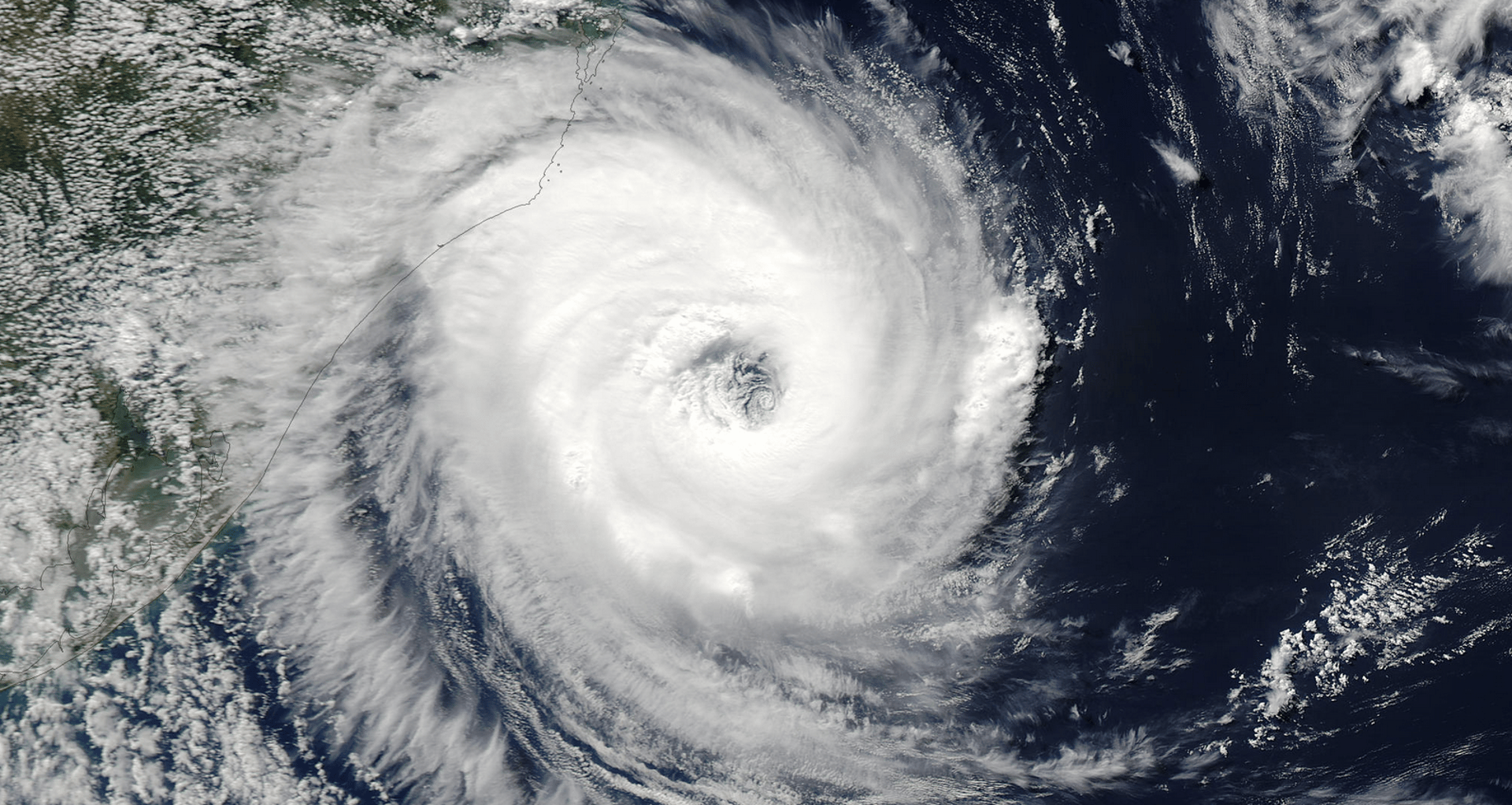
Image at top of page: Tropical Cyclone 27March2004 off of Brazil by NASA
Image credit: NHC/NOAA (Source); data 2004 to 2021. This may differ from other organizations historical maps.
Note: Weather satellites did not exist until 1960's & sub-tropical storm classification rules have changed, some data may be missing.
Historical tropical and sub-tropical cyclone tracks for the South Atlantic basin.

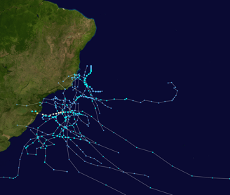
Image credit: South Atlantic Tropical Cyclone Wiki (Source). This may differ from other organizations historical maps.
Note: Weather satellites did not exist until 1960's & sub-tropical storm classification rules have changed, some data may be missing.